 |
|

|
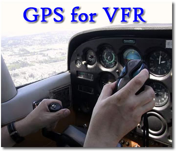
GPS for VFR
“Learn from the mistakes of others and avoid making them yourself.”
Graham suggests that, as VFR pilots using GPS, we not use it as a sole means of navigation, we not let confidence in the machine tempt us into flying in marginal weather and that we always carry and use up-to-date paper charts. Sound advice. I’d like to add one of my own experiences to bolster Mr. Graham’s point. On the morning of June 19, 1999, a friend of mine, we’ll just call him Billy, also a commercial pilot and flight instructor, my wife and I departed for a flight from Chilliwack for Bella Bella in a 1976 C-172 M equipped with VOR and GPS. The aircraft also has an ADF, but it was taking a short leave of absence from active duty at the time. We checked weather reports and received a briefing from Flight Services in Abbotsford. Reported weather along our route showed ceilings to be around 2000’ with local areas of lower cloud and some drizzle. We filed a flight plan and departed Chilliwack just after 0700, local time. Our plan was to fly through Vancouver Harbour, up the coast to Powell River, over Cortez and Quadra Islands and pick up V347 for Port Hardy. We planned a breakfast stop in Port Hardy before continuing our trip direct Bela Bela. Low cloud and fog forced us across the straits just past Sechelt, so we ended up flying to Port Hardy along the inland shore of Vancouver Island. Billy drove the airplane; I did the navigation and radio work. Having been a commercial fisherman I am familiar with our coastal waters, but, out of long habit, I used the greasy thumb method of navigation: every couple of minutes I identified where we were and clamped my thumb on the spot on the map. The GPS was ticking off the miles, giving our ground speed, heading, heading to destination, ETA, and all the other wonderful information it was capable of providing. Having worked with GPS as a fisherman and during an ocean crossing from the Canary Islands to Barbados, I had developed a guarded trust in the thing. GPS seems to work perfectly right up to the moment it doesn’t work at all. We had a nice breakfast in Port Hardy, chatted up the boys and girls flying with Pacific Coastal and prepared to depart for Bela Bela. The Pasco pilots who had just arrived from Bela Bela told us the cloud was quite low along the mainland shore, but conditions were a bit clearer along the outer islands. We opted to fly the outer route following V317 to Calvert Island then angling in along the outer shore of Hunter Island and in to Bela Bela via Raymond Passage. All was proceeding delightfully. Ceilings remained at around 1500’, the GPS ticked along and my thumb kept pace. Then, just abeam Goose Island, along the outer shore of Hunter Island in the gray and mist, Mr. GPS decided on an abrupt holiday: the screen went blank. Fortunately, my trusty thumb was up for the job and took over. We plotted our way along the shore, up Raymond Passage and landed in Bela Bela. On our return, at just about the same spot we had experienced our inbound GPS failure, the little honey sprang back to life giving us all the wonderful, precise data it is capable of prodiving. The good news is, of course, that we simply carried on to our destination. No harm, no foul. However, had one of us been flying on his own and depending on the GPS for all the required information, it could have been a serious situation. Anyone who has spent time flying up the coast can tell you that it all looks remarkably similar, particularly on a low ceiling, cloudy, misty day. More than one pilot has made the mistake of flying up a blind inlet thinking it was safe passage. GPS is an awesome addition to our set of navigation
aids. When it works, it is a thing of beauty. But, like every other machine
ever built, it has its quirks, and it does fail. Just like we always remind
ourselves to leave a way out when flying, it’s a very good plan
to always include a backup method in our navigation. When you get right
down to it, for VFR flying, the old greasy thumb method has a pretty high
reliability factor. As one of my instructors once said, “The best
way to avoid getting lost is to stay found: keep track of where you are.” |